The Sacramento Wheelmen do an outstanding job running this century.
I started doing this ride several years back. It's sort of known as the "wandering century." Over the 39-years the Sacramento Wheelmen have hosted this ride, it's apparently covered a few different routes, beginning at different locations. When I first rode it, we started out of Rocklin CA. In 2012, they moved it back to the "Slug Gulch" route, beginning from the Plymouth CA fairgrounds. Truly world class here. An excellent selection of roads, with well supported and nicely spaced rest stops.
The route takes you through some very interesting and quaint little towns full of California gold rush history that are off the beaten path.
I highly recommend the "double century" option if you're up for it. Although the regular century is no weakling ride either. Both tackle Slug Gulch beginning at about mile 77.
Here's what the Sacramento Wheelmen say about Slug Gulch (copied from their website):
"How tough is the climb up Slug Gulch?
Slug Gulch Road is a 5.4 mile 1300 feet climb that begins at Mile 77 on the Century and Double Metric Challenge routes. The most difficult part of the climb is the first 1 1/2 miles which include grades of up to 15 percent near the start and around the one mile point. After the first 1 1/2 miles, the road grade becomes more moderate and varied in the single digit range for about another mile. At about mile 2.5 of the road, the road takes a short steep hairpin turn after which the rest of the climb is moderate and increasingly gentle and even flat near the end. Riders who reach the Rest Stop at Indian Diggings School at the end of the climb are awarded the Slug Gulch Pin. Despite its name, the road includes several ranches, residences, and wineries as well as many scenic vistas and usually at least a few curious and supportive spectators."
How did Slug Gulch gets its name?
The website of the Oakstone Winery–which is located on Slug Gulch Road–offers the following history of the road's name:
"Like almost all of California's gold rush, the truth is clouded by countless retellings of oral history, but the prevailing version is that a prospector was poking around an old river bed at about the 3000 foot elevation of southern El Dorado County when he first came across a piece of gold the size of (pick one) a man's thumb, or a man's fist. Gold comes in dust, flakes, nuggets and slugs, with slugs this size being very desirable, indeed (the $50 gold piece of the late 1800's was known colloquially as a "slug" as well). The name was applied to the name of the mine that was developed at the site, and then to the road that led from the settlement in Fair Play to the mine."
Rather than use a plain and obscure-looking slug of gold for its logo, the Sierra Century founders decided to adopt instead a friendly, athletic version of the shell-less terrestrial gastropod mollusc commonly know as a slug. Some local residents have suggested that the logo is more like a metaphor or icon for how fast most century rides move up Slug Gulch Road.
----
During your ride, you will want to stay aware of your time though. If you're not at the top of Slug Gulch by 2:00pm, you'll be re-routed to the regular century route. This means that you will miss-out on an extra 1000' of climbing. We started at about 7:00am. We kept our stops brief and even skipped one or two rest stops. We hit the top of Slug Gulch at about 1:30pm.
I'd recommend this as a good century for Death Ride training.
Showing posts with label ride. Show all posts
Showing posts with label ride. Show all posts
Sunday, June 1, 2014

Sunday, October 6, 2013
Tour De Fuzz (2013)
Another great Tour De Fuzz!
This year, I got my buddy Johnny to join me. He and I rode this together in 2011 for the first time. I did it solo in 2012. And this year, Johnny was back for 2013.
Last year they added an optional timed hill climb feature for the climb up the Geysers. It's optional to participate. If you look at the ride on Strava, the section is labeled "Skipstone". It's a 4-mile climb at 8.5% grade. It begins about 19 miles into the century. A good way to get yourself cooked and leave another 75 miles to finish the ride! Link to results.
Some views from the climb up Geysers
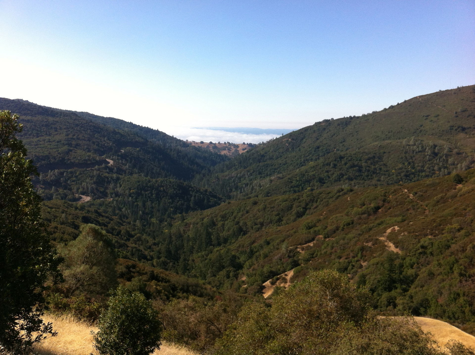
Here's a link to the route
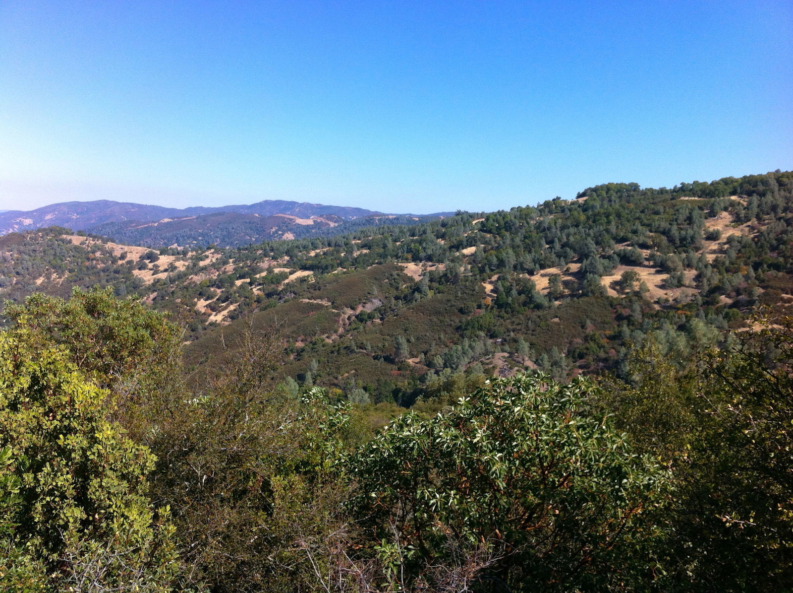
Beyond the great route, I have to sadly admit, my favorite part part of this century is the food! The past two years, they've thrown down with some awesome barbequed pork for the after-ride meal! Pig! What else would the 'Fuzz' serve, right?! And they don't skimp. They're not anal about collecting tickets and rationing out your serving. If you want more, go get it. Along with the pulled pork, they had healthy vegetables, coleslaw, potato salad. You could also have bbq'd chicken (I stuck with the pork though). Same for the beer. It flows like water. No ticket exchange, or counting. You want a beer? Go get it. No big lines. Just what you would want if you just finished 100 miles and were thirsty for a beer.
So, do me a favor, and don't tell anyone about this awesome century 'cuz I don't want it to get all screwed up with too many people signing up and making it difficult for me to get in ;-)
This year, I got my buddy Johnny to join me. He and I rode this together in 2011 for the first time. I did it solo in 2012. And this year, Johnny was back for 2013.
Last year they added an optional timed hill climb feature for the climb up the Geysers. It's optional to participate. If you look at the ride on Strava, the section is labeled "Skipstone". It's a 4-mile climb at 8.5% grade. It begins about 19 miles into the century. A good way to get yourself cooked and leave another 75 miles to finish the ride! Link to results.
Some views from the climb up Geysers
Here's a link to the route
Beyond the great route, I have to sadly admit, my favorite part part of this century is the food! The past two years, they've thrown down with some awesome barbequed pork for the after-ride meal! Pig! What else would the 'Fuzz' serve, right?! And they don't skimp. They're not anal about collecting tickets and rationing out your serving. If you want more, go get it. Along with the pulled pork, they had healthy vegetables, coleslaw, potato salad. You could also have bbq'd chicken (I stuck with the pork though). Same for the beer. It flows like water. No ticket exchange, or counting. You want a beer? Go get it. No big lines. Just what you would want if you just finished 100 miles and were thirsty for a beer.
So, do me a favor, and don't tell anyone about this awesome century 'cuz I don't want it to get all screwed up with too many people signing up and making it difficult for me to get in ;-)
Friday, May 10, 2013
Wine Country Century (WCC) 200k
Great day on the bike!
This was another last minute decision. I originally had plans to ride with a buddy, but something came up and he was suddenly unavailable. I looked around on-line and found this century. The tough part was that it was sold out. This is a very popular ride. Registration opens in February and usually closes right after. Fortunately, they have a pretty simple transfer process and I was able to find someone on Craigslist who was suddenly unable to ride. A couple of text messages and paypal clicks, and the entry was mine.
There are lots of popular century routes that begin around Santa Rosa CA. This is one of many. Some of the same roads are used in Levi's Gran Fondo, the Tour de Fuzz, and probably dozens of others. Some of the intersections have so many route marking directions it's difficult to know what direction you are supposed to go.
The weather was unbelievably nice on this day. The coast was clear and beautiful. Things heated up as we moved back inland. Many riders were sagging out after the lunch stop. Sadly, one pour guy lost his life on this day. His heart gave out about 10 miles before the lunch stop. This hit me pretty hard as I witnessed the responders administering CPR on the roadside without success. News of riders death.
Here are a few pics from the day.
Early in the climb up Coleman Valley, looking east.
Near the top of Coleman Valley Rd.
Coleman Valley Rd., just as you drop down to the coast.
Hwy 1 as you head north toward Jenner.
Beginning the trek back inland along the Russian River / Hwy 116
The many Russian River crossings
Here are all the beautiful details from my GPS. Click on "view full route"
This was another last minute decision. I originally had plans to ride with a buddy, but something came up and he was suddenly unavailable. I looked around on-line and found this century. The tough part was that it was sold out. This is a very popular ride. Registration opens in February and usually closes right after. Fortunately, they have a pretty simple transfer process and I was able to find someone on Craigslist who was suddenly unable to ride. A couple of text messages and paypal clicks, and the entry was mine.
There are lots of popular century routes that begin around Santa Rosa CA. This is one of many. Some of the same roads are used in Levi's Gran Fondo, the Tour de Fuzz, and probably dozens of others. Some of the intersections have so many route marking directions it's difficult to know what direction you are supposed to go.
The weather was unbelievably nice on this day. The coast was clear and beautiful. Things heated up as we moved back inland. Many riders were sagging out after the lunch stop. Sadly, one pour guy lost his life on this day. His heart gave out about 10 miles before the lunch stop. This hit me pretty hard as I witnessed the responders administering CPR on the roadside without success. News of riders death.
Here are a few pics from the day.
Early in the climb up Coleman Valley, looking east.
 |
| From Crankbased |
Near the top of Coleman Valley Rd.
 |
| From Crankbased |
Coleman Valley Rd., just as you drop down to the coast.
 |
| From Crankbased |
 |
| From Crankbased |
Hwy 1 as you head north toward Jenner.
 |
| From Crankbased |
 |
| From Crankbased |
Beginning the trek back inland along the Russian River / Hwy 116
 |
| From Crankbased |
The many Russian River crossings
 |
| From Crankbased |
 |
| From Crankbased |
 |
| From Crankbased |
Here are all the beautiful details from my GPS. Click on "view full route"
Saturday, March 16, 2013
Blue Ribbon Road Ride: Woodside - Pescadero Loop
One of my all time favorite bay area road rides -- Woodside (or there abouts) to Pescadero.
What's required to make it one of the all-time greats?
Good climbs
World-class views
Fun descents
Decent roads
Few cars
Good eats
This ride checks all those boxes and then some.
I have two locations where I recommend to start this ride.
You can start from the town of Woodside -- There's a park-n-ride parking lot just off 280 at 84. OR, if you'd like to add a few extra warm-up/cool-down rolling miles, you can start on Canada Rd., at the junction with hwy 92.
The ride is a fairly simple loop that takes you over a wooded ridge, drops you down through picturesque villages, and provides a bike-friendly lunch stop before leading you up the beautiful California coastline where you will turn inland for an amazing climb back through the woods and finally descending back to Woodside. I've discovered a few "add-ons" or alternates that make the ride more interesting if you care to mix it up a bit.
Here's the route with all the bells and whistles thrown in:
To shorten the ride, you can start in Woodside and eliminate the Canada Rd. out-n-back portion. Also, once you descend Pescadero Creek Rd., you can roll straight into the town of Pescadero for lunch and skip the little southern loop on Butano Creek / Cloverdale Rd.
Once you hit Pescadero, plan to stop at the biker friendly deli/grocery store for lunch: Arcangeli / Norms Market. Just around back of the store is a little grassy area with picnic tables, a water spigot, and an outhouse. Just about everything one would need in a reststop. The store is known for their artichoke bread. They bake some tasty sweets too. But I usually go for a nice sandwich from their awesome deli menu.
As you leave Pescadero, you head north on the lightly traveled Stage Road to San Gregorio. There's one last little rest stop opportunity at the General Store. Further up Stage Rd. you'll dump onto Hwy 1 for a short distance before you begin your climb back inland, up and over the ridge. You can keep it simple, and turn Rt., directly on to Tunitas Creek Rd. (previously used on the Tour of California), or you can continue up Hwy 1 a short distance to Verde Rd. (my preferred route) as I show on the map above. You'll turn Rt. from Verde Rd. onto Lobitos Creek Rd. (pass the Lobitos Crk Rd. Cutt-Off). It's a super sharp Rt. turn onto Lobitos Creek Rd. and might be easy to miss.
Most of the time I'm enjoying myself too much to take pictures, but I recently snapped a few from the climb heading back up the ridge after leaving the coast. I think these are mostly from the Lobitos Creek Rd. portion.


Once you drop back down to Tunitas Creek, and resume your climb back over the ridge, you enter into a beautiful redwood forest. My pics from that portion of the ride didn't turn out because of the low light conditions. The Tunitas Creek climb is long and beautiful through a dense redwood/fern forest. Once you reach the summit, where Tunitas Creek meets Skyline / Hwy 35 -- you've basically finished all of the real work. Careful as you descend back into Woodside. And if you decided to log the extra miles of Canada Rd. -- Congratulations for finishing the whole enchilada!
This truly is one of my favorite bay area rides. If you are visiting and looking for an amazing adventure that shows off the beautiful California coast and coastal range mountains -- this is it!
What's required to make it one of the all-time greats?
Good climbs
World-class views
Fun descents
Decent roads
Few cars
Good eats
This ride checks all those boxes and then some.
I have two locations where I recommend to start this ride.
You can start from the town of Woodside -- There's a park-n-ride parking lot just off 280 at 84. OR, if you'd like to add a few extra warm-up/cool-down rolling miles, you can start on Canada Rd., at the junction with hwy 92.
The ride is a fairly simple loop that takes you over a wooded ridge, drops you down through picturesque villages, and provides a bike-friendly lunch stop before leading you up the beautiful California coastline where you will turn inland for an amazing climb back through the woods and finally descending back to Woodside. I've discovered a few "add-ons" or alternates that make the ride more interesting if you care to mix it up a bit.
Here's the route with all the bells and whistles thrown in:
To shorten the ride, you can start in Woodside and eliminate the Canada Rd. out-n-back portion. Also, once you descend Pescadero Creek Rd., you can roll straight into the town of Pescadero for lunch and skip the little southern loop on Butano Creek / Cloverdale Rd.
Once you hit Pescadero, plan to stop at the biker friendly deli/grocery store for lunch: Arcangeli / Norms Market. Just around back of the store is a little grassy area with picnic tables, a water spigot, and an outhouse. Just about everything one would need in a reststop. The store is known for their artichoke bread. They bake some tasty sweets too. But I usually go for a nice sandwich from their awesome deli menu.
As you leave Pescadero, you head north on the lightly traveled Stage Road to San Gregorio. There's one last little rest stop opportunity at the General Store. Further up Stage Rd. you'll dump onto Hwy 1 for a short distance before you begin your climb back inland, up and over the ridge. You can keep it simple, and turn Rt., directly on to Tunitas Creek Rd. (previously used on the Tour of California), or you can continue up Hwy 1 a short distance to Verde Rd. (my preferred route) as I show on the map above. You'll turn Rt. from Verde Rd. onto Lobitos Creek Rd. (pass the Lobitos Crk Rd. Cutt-Off). It's a super sharp Rt. turn onto Lobitos Creek Rd. and might be easy to miss.
Most of the time I'm enjoying myself too much to take pictures, but I recently snapped a few from the climb heading back up the ridge after leaving the coast. I think these are mostly from the Lobitos Creek Rd. portion.


Once you drop back down to Tunitas Creek, and resume your climb back over the ridge, you enter into a beautiful redwood forest. My pics from that portion of the ride didn't turn out because of the low light conditions. The Tunitas Creek climb is long and beautiful through a dense redwood/fern forest. Once you reach the summit, where Tunitas Creek meets Skyline / Hwy 35 -- you've basically finished all of the real work. Careful as you descend back into Woodside. And if you decided to log the extra miles of Canada Rd. -- Congratulations for finishing the whole enchilada!
This truly is one of my favorite bay area rides. If you are visiting and looking for an amazing adventure that shows off the beautiful California coast and coastal range mountains -- this is it!
Saturday, November 3, 2012
Another Favorite NorCal Road Ride: Lucas Valley - Tomales Loop
I love this ride. It has just about everything I could want:
Easy access
Good roads
Great mix of terrain
World-class scenic views
Rest stops nicely spaced
Great food choices
What else do you need for an excellent ride?


Let me lay it out for you -
Roll out Lucas Valley Rd for a nice warm up before you hit your first manageable climb. Cresting the beautiful summit, you'll enjoy a nice downhill through a redwood forest -- just like going to summer camp!
Hit the "T" and turn right to roll into the quaint little town of Nicasio. The town is like a movie set for Pleasantville USA. A general store and portable toilets standing by.
Continue to the next intersection with Pt. Reyes - Petaluma Rd. and head right for your second noticeable climb. I tend to move through this section fairly quick as cars are moving fast and the road shoulder comes and goes.
As you drop down the other side and hit the flats, you'll come to the cheese factory. Great rest area with restrooms, picnic tables, and a fountain to refill your water.
Head down the road a bit further and hang a left on Hicks Valley Rd. This is where the real rural fun begins and you can get away from the cars and enjoy some good ol' country roads.
Rt on Wilson Hill (there's another hill here) drop down the other side then left on Chileno Valley Rd. Take this to the end and turn left on Tomales - Petaluma Rd. You will eventually T into Hwy 1. Make sure you turn right here for the detour into the town of Tomales. There's a bakery there that shouldn't be missed.
Once you carbo load on some fresh baked sweets, backtrack a bit and continue south on Hwy 1. Now you'll begin one of the most scenic sections of this ride as you head down the shores of Tomales Bay. Unbelievably beautiful. On this trip, we stopped at one of the oyster farms along the way. We bought a dozen small oysters and borrowed a shucking knife. That was basically our lunch stop.
Continue south and head into the town of Point Reyes Station. If you're not down with the oysters, there are plenty of options here for you to refuel and rest up before the last leg. My favorite stop is the Cowgirl Creamery where they make cheese. They have a deli for sandwiches and a nice yard area to eat and relax. At the far end of town is a killer burrito stop. If you need a spare tube or something checked out, go see my buddy Mike Varley who operates Black Mountain Cycles. Stop in and look around at some killer old school mountain bikes. Hang out on the couch and rest up before you head back.
From Pt. Reyes Station, backtrack north back up Hwy 1 for a bit and take the right turn on Pt Reyes - Petaluma Rd. Take this back to Nicasio Valley Rd. and then backtrack all the way over Lucas Valley Rd. back to the start location.
One sweet ride.
Edit 5-25-14: So, maybe you'd like a few more miles? Here's the same ride with a few bonus miles up north: http://ridewithgps.com/trips/2709728
Once you hit the hwy 1 / valley ford area, there's a nice little deli with great sandwiches. It's about 48 miles into the ride -- near mid-point of the ride. Total ride distance with north loop add on = 106 miles.
Easy access
Good roads
Great mix of terrain
World-class scenic views
Rest stops nicely spaced
Great food choices
What else do you need for an excellent ride?
Let me lay it out for you -
Roll out Lucas Valley Rd for a nice warm up before you hit your first manageable climb. Cresting the beautiful summit, you'll enjoy a nice downhill through a redwood forest -- just like going to summer camp!
Hit the "T" and turn right to roll into the quaint little town of Nicasio. The town is like a movie set for Pleasantville USA. A general store and portable toilets standing by.
Continue to the next intersection with Pt. Reyes - Petaluma Rd. and head right for your second noticeable climb. I tend to move through this section fairly quick as cars are moving fast and the road shoulder comes and goes.
As you drop down the other side and hit the flats, you'll come to the cheese factory. Great rest area with restrooms, picnic tables, and a fountain to refill your water.
Head down the road a bit further and hang a left on Hicks Valley Rd. This is where the real rural fun begins and you can get away from the cars and enjoy some good ol' country roads.
Rt on Wilson Hill (there's another hill here) drop down the other side then left on Chileno Valley Rd. Take this to the end and turn left on Tomales - Petaluma Rd. You will eventually T into Hwy 1. Make sure you turn right here for the detour into the town of Tomales. There's a bakery there that shouldn't be missed.
Once you carbo load on some fresh baked sweets, backtrack a bit and continue south on Hwy 1. Now you'll begin one of the most scenic sections of this ride as you head down the shores of Tomales Bay. Unbelievably beautiful. On this trip, we stopped at one of the oyster farms along the way. We bought a dozen small oysters and borrowed a shucking knife. That was basically our lunch stop.
Continue south and head into the town of Point Reyes Station. If you're not down with the oysters, there are plenty of options here for you to refuel and rest up before the last leg. My favorite stop is the Cowgirl Creamery where they make cheese. They have a deli for sandwiches and a nice yard area to eat and relax. At the far end of town is a killer burrito stop. If you need a spare tube or something checked out, go see my buddy Mike Varley who operates Black Mountain Cycles. Stop in and look around at some killer old school mountain bikes. Hang out on the couch and rest up before you head back.
From Pt. Reyes Station, backtrack north back up Hwy 1 for a bit and take the right turn on Pt Reyes - Petaluma Rd. Take this back to Nicasio Valley Rd. and then backtrack all the way over Lucas Valley Rd. back to the start location.
One sweet ride.
Edit 5-25-14: So, maybe you'd like a few more miles? Here's the same ride with a few bonus miles up north: http://ridewithgps.com/trips/2709728
Once you hit the hwy 1 / valley ford area, there's a nice little deli with great sandwiches. It's about 48 miles into the ride -- near mid-point of the ride. Total ride distance with north loop add on = 106 miles.
Sunday, September 16, 2012
San Francisco By Bike!
So much fun!
I've been wanting to ride my bike around San Francisco for quite a while. Seeing the city from a bike seemed like a great little adventure.
Although I've ridden parts of the city before (across the Golden Gate Bridge and into Crissy Field, Pier 39, and the Embarcadero), I've never taken my bike on BART or toured the other great San Francisco neighborhoods.
I started out with about a 45 minute Bay Area Rapid Transit (BART) train ride into San Francisco, getting off at the Embaradero station. This put me about a block away from the Ferry Building at the waterfront -- near the base of the Bay Bridge that spans over to Treasure Island and back toward Oakland.

It's about 4 miles of mellow cruising along the waterfront filled with tourists, restaurants, shops, etc. until you reach Pier 39. Thankfully, there's a decent bike lane that makes biking easy and enjoyable. Pier 39 is a zoo though -- I try to get through here quickly.
Another mile or two brings you to the Crissy Field area, where the Presidio meets the water of the bay. I love it down here. Paths roll along between sand dunes and beaches on one side, and grassy play areas on the other. People are out flying kites, playing fetch with the dog, bbqing. Lots of young local beautiful people out for a jog or a stroll with the kids.
Up to the southern base of the Golden Gate Bridge -- another heavy tourist zone. Didn't spend much time here. Passing under the bridge brings you to one of the most spectacular neighborhoods I've ever seen - Sea Cliff. The most beautifully maintained vintage homes overlooking the Pacific Ocean, just to the west of the Golden Gate Bridge. To live there must be a magical life.
I've been riding in an arc that followed along the shore of the bay. From the Bay Bridge, I rode north, looping to the west. From the Golden Gate Bridge, the route along the edge turns south. I passed by bunkers that date back to the early days of California and helped protect the bay from attack.
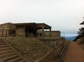
Here's my weapon of choice for today's urban assault. It's an old Klein Pinnacle set up with dirt drop bars and bar end shifters. Fun bike!

I ended up near the Legion of Honor -- a spectacular building atop a bluff with great views east back toward the city


I continuing south along the western edge with views of Baker Beach.


A short distance further, I rolled passed the old remnants of the Sutro Baths

And the Cliff House (where it looks like a great place to enjoy a meal from a window seat)

From here, you have views to the south along the long stretch of Ocean Beach


From the Ocean Beach area, I ducked into the far west end of Golden Gate Park on JFK drive and started heading back inland, away from the coast, into the heart of San Francisco.
Festivities were everywhere

Exiting GG Park at the east end of the "pan handle", I dropped into "The Haight"

Had to find the corner of "Haight - Ashbury" -- there's a Ben and Jerry's Ice Cream store here. Great area filled with interesting shops, the smell of pot, and lots of people. I grabbed a latte in a local neighborhood coffee shop -- Coffee to the People.

 From here I continued a bit east and down through the Castro district. It did not disappoint. The area was filled with lots of colorful people from all walks of life.

Next, a little more east, I hit the Mission District of San Francisco. I made a brief stop at Delores Park. Lots of locals just hanging out on the grass -- smoking grass.

One of my main goals was to eat Mexican food in the Mission District. I chose a little place called La Taqueria on Mission Street. It did not disappoint. I watched them make these "el dorado" style tacos and had to order two. (A crispy tortilla with cheese inside a soft tortilla, loaded with meat, salsa and all kinds of goodness). Get some!

It was about 3:30pm when I finished with my tacos so I needed to start heading back.
Here's the whole route loaded up from my GPS:
Strava
I didn't really know what I was doing when I started out. I did a little research in the morning on various GPS sites where others had done similar routes. I also downloaded an iPhone app ("bikeroute") that did a pretty good job of showing me the best bike routes through town. I did notice though that my AT&T iPhone was struggling over here. Yelp was hanging up, other apps were running way too slow or not functioning at all. Not sure if it was just a bad day or if that is typical. It did hamper me getting around a bit because I was sort of figuring it out on the fly and the iPhone was my primary resource.
Anyway... the bikeroute app let me know that Folsom Street was a good route northwest back to the Embarcadero where I jumped back on the BART train for the trip back home.
Great day!
I've been wanting to ride my bike around San Francisco for quite a while. Seeing the city from a bike seemed like a great little adventure.
Although I've ridden parts of the city before (across the Golden Gate Bridge and into Crissy Field, Pier 39, and the Embarcadero), I've never taken my bike on BART or toured the other great San Francisco neighborhoods.
I started out with about a 45 minute Bay Area Rapid Transit (BART) train ride into San Francisco, getting off at the Embaradero station. This put me about a block away from the Ferry Building at the waterfront -- near the base of the Bay Bridge that spans over to Treasure Island and back toward Oakland.

It's about 4 miles of mellow cruising along the waterfront filled with tourists, restaurants, shops, etc. until you reach Pier 39. Thankfully, there's a decent bike lane that makes biking easy and enjoyable. Pier 39 is a zoo though -- I try to get through here quickly.
Another mile or two brings you to the Crissy Field area, where the Presidio meets the water of the bay. I love it down here. Paths roll along between sand dunes and beaches on one side, and grassy play areas on the other. People are out flying kites, playing fetch with the dog, bbqing. Lots of young local beautiful people out for a jog or a stroll with the kids.
Up to the southern base of the Golden Gate Bridge -- another heavy tourist zone. Didn't spend much time here. Passing under the bridge brings you to one of the most spectacular neighborhoods I've ever seen - Sea Cliff. The most beautifully maintained vintage homes overlooking the Pacific Ocean, just to the west of the Golden Gate Bridge. To live there must be a magical life.
I've been riding in an arc that followed along the shore of the bay. From the Bay Bridge, I rode north, looping to the west. From the Golden Gate Bridge, the route along the edge turns south. I passed by bunkers that date back to the early days of California and helped protect the bay from attack.

Here's my weapon of choice for today's urban assault. It's an old Klein Pinnacle set up with dirt drop bars and bar end shifters. Fun bike!

I ended up near the Legion of Honor -- a spectacular building atop a bluff with great views east back toward the city
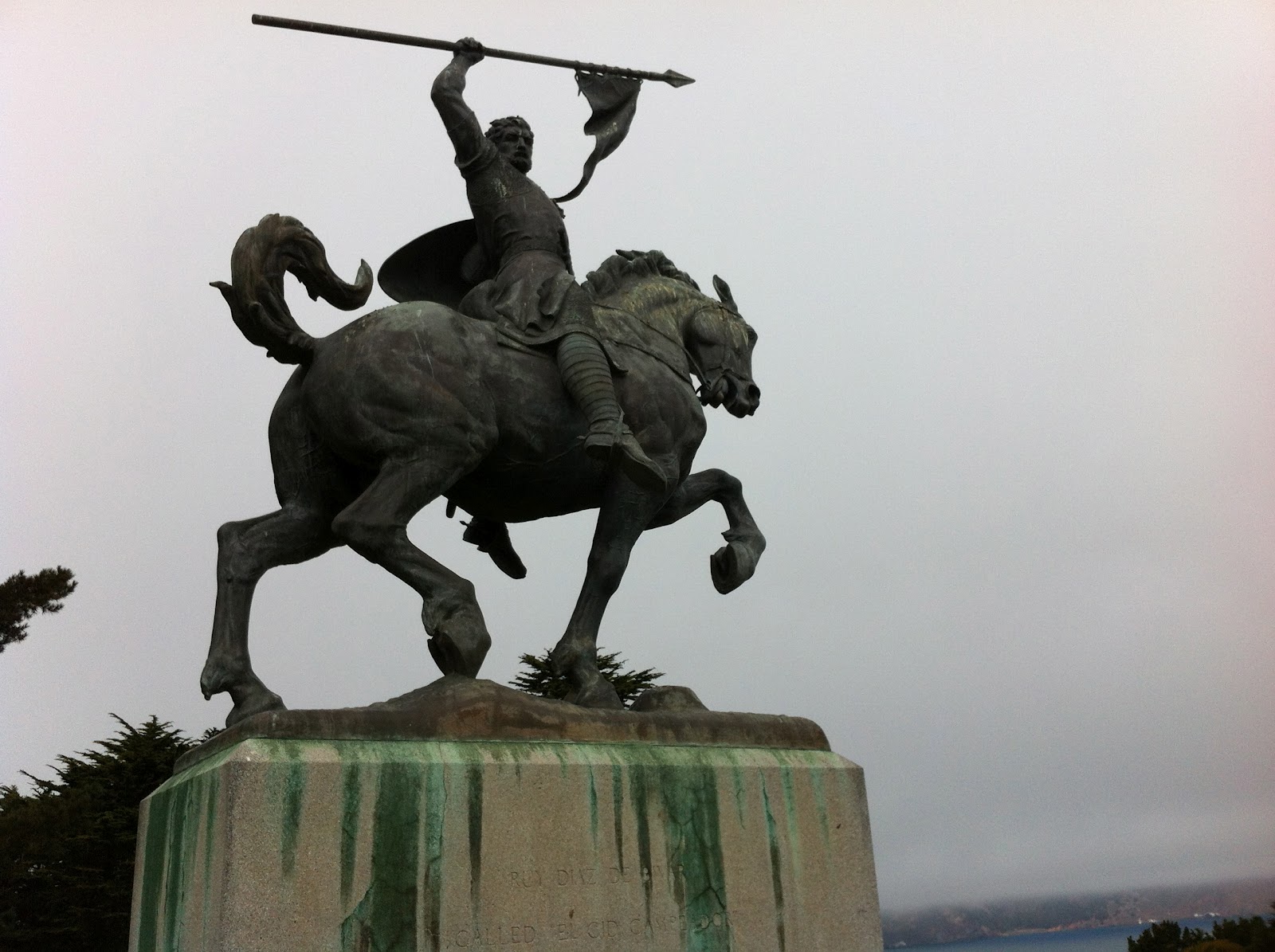

I continuing south along the western edge with views of Baker Beach.


A short distance further, I rolled passed the old remnants of the Sutro Baths

And the Cliff House (where it looks like a great place to enjoy a meal from a window seat)

From here, you have views to the south along the long stretch of Ocean Beach


From the Ocean Beach area, I ducked into the far west end of Golden Gate Park on JFK drive and started heading back inland, away from the coast, into the heart of San Francisco.
Festivities were everywhere

Exiting GG Park at the east end of the "pan handle", I dropped into "The Haight"

Had to find the corner of "Haight - Ashbury" -- there's a Ben and Jerry's Ice Cream store here. Great area filled with interesting shops, the smell of pot, and lots of people. I grabbed a latte in a local neighborhood coffee shop -- Coffee to the People.


Next, a little more east, I hit the Mission District of San Francisco. I made a brief stop at Delores Park. Lots of locals just hanging out on the grass -- smoking grass.

One of my main goals was to eat Mexican food in the Mission District. I chose a little place called La Taqueria on Mission Street. It did not disappoint. I watched them make these "el dorado" style tacos and had to order two. (A crispy tortilla with cheese inside a soft tortilla, loaded with meat, salsa and all kinds of goodness). Get some!

It was about 3:30pm when I finished with my tacos so I needed to start heading back.
Here's the whole route loaded up from my GPS:
Strava
I didn't really know what I was doing when I started out. I did a little research in the morning on various GPS sites where others had done similar routes. I also downloaded an iPhone app ("bikeroute") that did a pretty good job of showing me the best bike routes through town. I did notice though that my AT&T iPhone was struggling over here. Yelp was hanging up, other apps were running way too slow or not functioning at all. Not sure if it was just a bad day or if that is typical. It did hamper me getting around a bit because I was sort of figuring it out on the fly and the iPhone was my primary resource.
Anyway... the bikeroute app let me know that Folsom Street was a good route northwest back to the Embarcadero where I jumped back on the BART train for the trip back home.
Great day!
Saturday, September 15, 2012
Tour De Fuzz (2012)
I made a last minute decision Friday night to log in another century. I traveled two hours north (leaving at 5am) in order to ride the Tour De Fuzz century. This century is a fund raiser for law enforcement agencies in Sonoma County.
I did this ride last year and thought it was one of the best centuries I've ever participated in. When it came up this year, I didn't want to miss it. This is the third year in a row that they've put this on. I've ridden the last two.
What makes this a great century:
* Route -
The Northern CA wine country and geysers area is remarkably beautiful.
* Support -
Lots of friendly volunteers available every step of the way. Want to challenge yourself? The 4-mile Geysers hill climb is an optional timed event if you'd like to participate (I ended up 8th in my age group of 28, and 20th out of a group of 87 -- I'm a solid mid-packer! :-)
* Food -
Nice breakfast spread before you even hit the road. Rest stops were nicely spaced and stocked with good cycling-specific products such as Clif Shots, shot blocks, GU's, chews, etc. in addition to the traditional bananas, cookies, nuts, PB&J sandwiches, bagels, baked mini potatoes (love those things!), etc.
Lunch included a nice selection of pre-made sandwiches along with an outstanding and healthy pasta salad. The post ride meal was over-the-top -- pulled bbq pork (and tons of it) along with BBQ chicken, potato salad, and free-flowing Lagunitas beer!
* Entertainment -
Music, law enforcement demo's, silent auctions, raffle drawings, swimming pool, shower, etc.
* Value -
Excellent route/scenery, support, great food, T-shirt. All adds up to be one of the finest centuries around.
I did this ride last year and thought it was one of the best centuries I've ever participated in. When it came up this year, I didn't want to miss it. This is the third year in a row that they've put this on. I've ridden the last two.
What makes this a great century:
* Route -
The Northern CA wine country and geysers area is remarkably beautiful.
* Support -
Lots of friendly volunteers available every step of the way. Want to challenge yourself? The 4-mile Geysers hill climb is an optional timed event if you'd like to participate (I ended up 8th in my age group of 28, and 20th out of a group of 87 -- I'm a solid mid-packer! :-)
* Food -
Nice breakfast spread before you even hit the road. Rest stops were nicely spaced and stocked with good cycling-specific products such as Clif Shots, shot blocks, GU's, chews, etc. in addition to the traditional bananas, cookies, nuts, PB&J sandwiches, bagels, baked mini potatoes (love those things!), etc.
Lunch included a nice selection of pre-made sandwiches along with an outstanding and healthy pasta salad. The post ride meal was over-the-top -- pulled bbq pork (and tons of it) along with BBQ chicken, potato salad, and free-flowing Lagunitas beer!
* Entertainment -
Music, law enforcement demo's, silent auctions, raffle drawings, swimming pool, shower, etc.
* Value -
Excellent route/scenery, support, great food, T-shirt. All adds up to be one of the finest centuries around.
Sunday, August 19, 2012
CA Central Coast: Rides and Fish Tacos!
Recently enjoyed a short but sweet family get away to Cayucos CA, along the beautiful central California coast.
Just north of the gigantic Morro rock in Morro Bay, CA
Just south of San Simeon, CA and the Hearst Castle
Know the place?
Anyway... it was awesome.
If you go -- or even pass within 50 miles -- you must stop in at Ruddell's Smokehouse for a smoked fish taco. It's a little shack -- so small, you can't even eat inside. You have to grab your food and hope there's room on the few rickety tables outside... or walk across the street and sit on the beach.
Even if you're not hungry -- get a taco and take it with you. They're wrapped up pretty well and should hold up until you do get hungry.
I'm not exactly sure what's in there besides the smoked fish (you have several choices of smoked fish... and if you're there early enough, you might even have the option of smoked oysters). Looks like chopped lettuce (the fancy red stuff), onion, celery, apple (gives a nice little sweetness), and some powdery magic sprinkled on (maybe Old Bay?). So damn good!
Git one! Ruddell's Smokehouse
(Here's a youtube video I found showing the place)
And of course I brought the road bike!
I was able to steal away for two road rides near by. Decent levels of climbing and distance -- enough to allow me evening cocktails and apps on the beach guilt free. That's all I'm ever after -- guilt free indulgence!
Day #1 Ride: Headed Northeast on Old Creek Rd right out of town. Climbed up and crossed over Hwy 46 (road becomes Santa Rosa Creek Rd on the other side of 46), climbed a bit more before downhilling into the town of Cambria, CA. Just a tip - Santa Rosa Creek Rd. is a little rough. I forgot to top-off my air pressure before heading out and ended up with a pinch flat after hitting a rough section. Once you hit Hwy 1 it's about 13 miles south back to Cayucos.
Day #2 Ride: Headed north on Hwy 1, then climbed east up 46 (about 10 miles of climbing) before downhilling southwest back to town on Old Creek Rd.
If you do these rides, you'll roll through Harmony. I was sad to learn that only 18 people live in Harmony. Really?

Both rides above head through beautiful country.
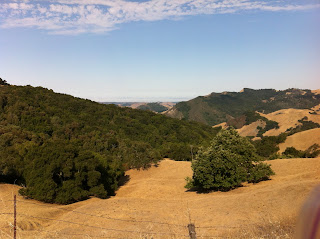

Had we stayed longer, I probably would have ridden north on Hwy 1 to San Simeon and the home of the famous Hearst Castle for an out-n-back ride. I think it's about 23 miles each way. I did this a few years ago.
A few things about Morro Bay...
I was craving some good fresh sea food -- particularly fresh, raw oysters. I headed down the road to Morro Bay and was referred to Giovanni's -- right down on the water near the harbor. They had a large selection of fresh fish. I grabbed a dozen fresh oysters and shucked them myself (I keep an oyster shucker tool in my truck -- just cuz'). I have to be honest, 3 of the 12 oysters were bad, and I threw them out. The rest were good though.
Giovanni's looks like a good place to grab lunch if you're down there walking around. You can walk up to the window and order all kinds of freshly cooked sea food items. They also serve bbq'd oysters right outside for $2 ea. or 3 for $5, and have all the sauces out to doctor 'em up.
We had a nice breakfast down in Morro Bay one morning at Frankie and Lola's. I'd give this place 2 thumbs up. Great menu and the food was awesome.
"Da Bomb"

Great trip... Just too short!!

Update Aug. 2014:
Added a new, longer loop to the mix. This will take you south from Cayucos, down to Morro Bay, then inland to SLO, and back to the coast at Pismo Beach. Great ride, with the exception of the headwind as you head northwest on Los Osos Valley Rd.
On this trip, I also opted to ride a previous loop in the opposite direction, here's what that looks like. I think this is the preferred direction. Although the climbing is tougher, you end up climbing the rough portions of the road (rather than descending the rough stuff) and when you finish the downhill, you're right back in Cayucos -- rather than dumping onto Hwy 1 for a 15 mile trip along the hwy.
Just north of the gigantic Morro rock in Morro Bay, CA
Just south of San Simeon, CA and the Hearst Castle
Know the place?
Anyway... it was awesome.
If you go -- or even pass within 50 miles -- you must stop in at Ruddell's Smokehouse for a smoked fish taco. It's a little shack -- so small, you can't even eat inside. You have to grab your food and hope there's room on the few rickety tables outside... or walk across the street and sit on the beach.
Even if you're not hungry -- get a taco and take it with you. They're wrapped up pretty well and should hold up until you do get hungry.
I'm not exactly sure what's in there besides the smoked fish (you have several choices of smoked fish... and if you're there early enough, you might even have the option of smoked oysters). Looks like chopped lettuce (the fancy red stuff), onion, celery, apple (gives a nice little sweetness), and some powdery magic sprinkled on (maybe Old Bay?). So damn good!
Git one! Ruddell's Smokehouse
(Here's a youtube video I found showing the place)
And of course I brought the road bike!
I was able to steal away for two road rides near by. Decent levels of climbing and distance -- enough to allow me evening cocktails and apps on the beach guilt free. That's all I'm ever after -- guilt free indulgence!
Day #1 Ride: Headed Northeast on Old Creek Rd right out of town. Climbed up and crossed over Hwy 46 (road becomes Santa Rosa Creek Rd on the other side of 46), climbed a bit more before downhilling into the town of Cambria, CA. Just a tip - Santa Rosa Creek Rd. is a little rough. I forgot to top-off my air pressure before heading out and ended up with a pinch flat after hitting a rough section. Once you hit Hwy 1 it's about 13 miles south back to Cayucos.
Day #2 Ride: Headed north on Hwy 1, then climbed east up 46 (about 10 miles of climbing) before downhilling southwest back to town on Old Creek Rd.
If you do these rides, you'll roll through Harmony. I was sad to learn that only 18 people live in Harmony. Really?

Both rides above head through beautiful country.


Had we stayed longer, I probably would have ridden north on Hwy 1 to San Simeon and the home of the famous Hearst Castle for an out-n-back ride. I think it's about 23 miles each way. I did this a few years ago.
A few things about Morro Bay...
I was craving some good fresh sea food -- particularly fresh, raw oysters. I headed down the road to Morro Bay and was referred to Giovanni's -- right down on the water near the harbor. They had a large selection of fresh fish. I grabbed a dozen fresh oysters and shucked them myself (I keep an oyster shucker tool in my truck -- just cuz'). I have to be honest, 3 of the 12 oysters were bad, and I threw them out. The rest were good though.
Giovanni's looks like a good place to grab lunch if you're down there walking around. You can walk up to the window and order all kinds of freshly cooked sea food items. They also serve bbq'd oysters right outside for $2 ea. or 3 for $5, and have all the sauces out to doctor 'em up.
We had a nice breakfast down in Morro Bay one morning at Frankie and Lola's. I'd give this place 2 thumbs up. Great menu and the food was awesome.
"Da Bomb"

Great trip... Just too short!!

Update Aug. 2014:
Added a new, longer loop to the mix. This will take you south from Cayucos, down to Morro Bay, then inland to SLO, and back to the coast at Pismo Beach. Great ride, with the exception of the headwind as you head northwest on Los Osos Valley Rd.
On this trip, I also opted to ride a previous loop in the opposite direction, here's what that looks like. I think this is the preferred direction. Although the climbing is tougher, you end up climbing the rough portions of the road (rather than descending the rough stuff) and when you finish the downhill, you're right back in Cayucos -- rather than dumping onto Hwy 1 for a 15 mile trip along the hwy.
Subscribe to:
Posts (Atom)